


Precise mobile laser scanning put to the test: the NavVis MLX in as-built capture
Mobile laser scanning with the NavVis MLX – how modern sensor fusion delivers stable results in glazed corridors and complex plant rooms.
For architects, engineers and facility managers, a dependable data basis is the foundation of every successful project. At Metrika360 , it is our aim to secure that certainty in planning through precise as-built surveys of buildings .
In order to work efficiently and to a high accuracy in demanding interiors as well, we have added the NavVis MLX to our portfolio. With the mobile laser scanning of the NavVis MLX , the gap between static terrestrial laser scanners (TLS) and mobile systems narrows further. But technical data sheets alone are no proof. We put the system through an intensive field test in order to probe the limits of 3D as-built documentation in critical environments.
1. The technology in focus: sensor fusion rather than laser measurement alone
The NavVis MLX is a hand-held system for mobile laser scanning that captures point clouds of buildings and 360° panoramas directly while moving. Its technical particularity lies in the way it determines its position in space.
Conventional mobile scanners often reach their limits in difficult environments. The MLX therefore uses an advanced sensor fusion for the SLAM algorithm (simultaneous localization and mapping):
- 32-layer LiDAR: The laser sensor captures the surroundings at 640,000 points per second. Distributing these across 32 layers produces an extremely dense vertical measurement grid. This ensures that even delicate structures such as narrow pipework or door rebates are reliably detected.
- Visual odometry: In parallel with the laser, integrated cameras continuously analyse the texture of the surroundings. This visual data supports the scanner’s position calculation wherever the laser, for physical reasons, can draw no conclusions.
2. Mobile laser scanning put to the test: transparency and symmetry
In the practice of construction surveying there are scenarios regarded as particularly critical for mobile algorithms: large areas of glazing and long, feature-poor corridors.
2.1 Stability in the glazed connecting corridor
One of the biggest sources of error in mobile laser scanning is what is known as “drift” at glass surfaces. Laser beams pass through glass or are reflected specularly, which leaves the SLAM algorithm without valid measurement points for the geometry.
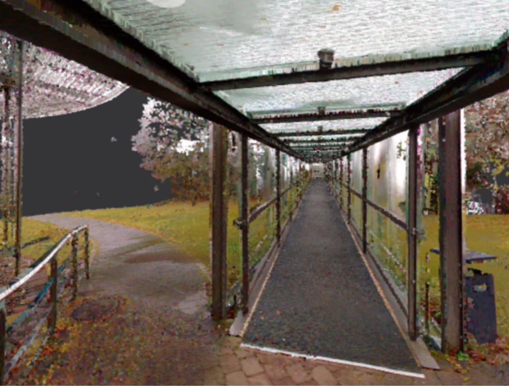
In our test building we captured a long, glazed connecting corridor. Here the advantage of sensor fusion showed clearly: while the LiDAR data naturally carried reduced information content at the glass surfaces, visual odometry took over the stabilisation. The cameras oriented themselves on the textures of the floor covering and the ceiling construction.
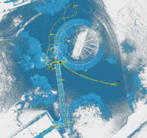
The result: A drift-free, geometrically correct trajectory through the entire glazed corridor.
2.2 Precision in long corridors
In extensive basement corridors with repetitive geometry (symmetry), the system also proved its capability. The sensor’s high point density and wide field of view allowed robust self-localisation. Analysis of the trajectory shows a clean “loop closure” – the start and end point of the measurement match exactly, which is decisive for the dimensional accuracy of the whole point cloud .
 3. Ergonomics in the plant room (building services)
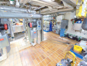
Besides algorithmic stability, physical handling in complex spaces is decisive for economical capture. Our test led into a plant room with low ceiling heights and dense pipework.
- Accessibility: Unlike backpack-based systems, which require a certain clear height, the design of the MLX makes it possible to pass beneath low-hanging pipes and ventilation ducts.
- Live feedback: Via the integrated touchscreen, the surveyor can check in real time whether concealed areas (shadows) have been captured sufficiently in the point cloud. This is essential for the later scan-to-BIM modelling, particularly with complex building services installations.
4. Conclusion: what it adds to your construction project
The successful use of the NavVis MLX under these demanding conditions confirms that mobile laser scanning is now a valid solution for complex geometries too.
For you as a client, this brings concrete benefits:
- Certainty in planning: Validated as-built data even in areas previously regarded as hard to capture (glass facades, long tunnels, crawl spaces).
- Economy: The high capture speed reduces time on site and minimises disruption to ongoing operations.
- Completeness: The combination of high-resolution geometry and 360° image data delivers a comprehensive digital twin of the existing building.
Do you need precise mobile laser scanning with the NavVis MLX for a demanding building?
Contact Metrika360 for a no-obligation conversation about your project.
Frequently asked questions about mobile 3D as-built documentation with the NavVis MLX
What is the NavVis MLX and how does it work?
The NavVis MLX is a hand-held mobile mapping system that captures precise 3D point clouds and 360° panoramic images of buildings in real time. It combines a 32-layer LiDAR sensor with visual odometry (SLAM algorithm) in order to orient itself reliably in space even without a GPS signal – at a capture rate of up to 640,000 points per second.
What are the advantages of mobile laser scanning over static scanners?
Mobile systems such as the NavVis MLX capture large areas considerably faster than stationary terrestrial laser scanners (TLS). Where a TLS has to be set up and measured afresh at every position, with the MLX you scan as you walk through the building. That saves up to 60–70 % of the time on site and minimises interruptions to operations.
Does the NavVis MLX also work in glazed corridors or heavily glazed areas?
Yes. This is one of the system’s particular strengths. Thanks to sensor fusion – the combination of LiDAR and visual odometry – the MLX compensates for gaps in the data at glass surfaces. While the laser yields little from transparent surfaces, the cameras orient themselves on the textures of floor and ceiling. The result: a drift-free, geometrically correct trajectory.
Which building types or projects is mobile laser scanning particularly suited to?
The system is ideally suited to: as-built surveys in office buildings, hospitals and industrial plants; plant rooms with tight pipework and low ceiling heights; glazed corridors and atria; extensive basement corridors and underground car parks; and buildings in ongoing use, where disruption has to be kept to a minimum.
Can mobile laser scanning disturb a building's ongoing operation?
Hardly. That is one of the greatest advantages of the mobile system. A single operator can walk discreetly through the building, without barriers, scaffolding or longer shutdowns. The MLX is quiet, compact and unobtrusive – ideal for use in hospitals, hotels or production facilities.
How does the NavVis MLX differ from backpack-based systems?
Backpack-based systems offer high mobility, but often require a certain clear room height and are unwieldy in tight areas. The NavVis MLX is carried in the hand and can easily be taken beneath low-hanging pipes, ventilation ducts or service lines – a decisive advantage in plant rooms and basements.