


Surveying from the air
Drone surveying for buildings and terrain
Roof, façade, terrain and everywhere that nothing works from the ground.
Photogrammetric capture from the air
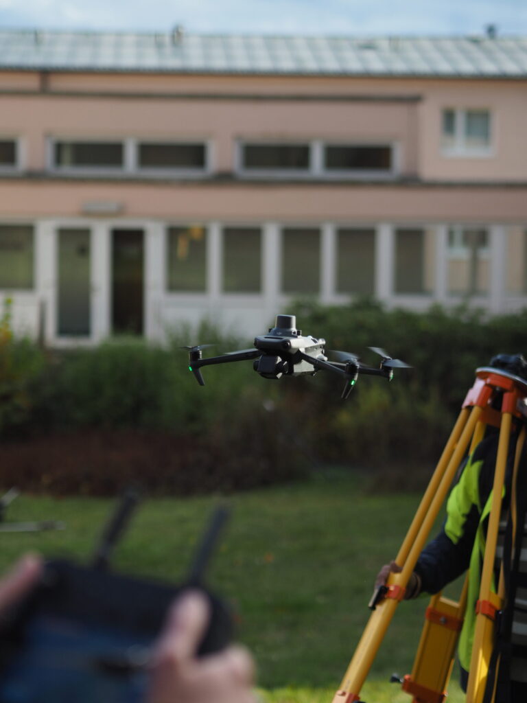
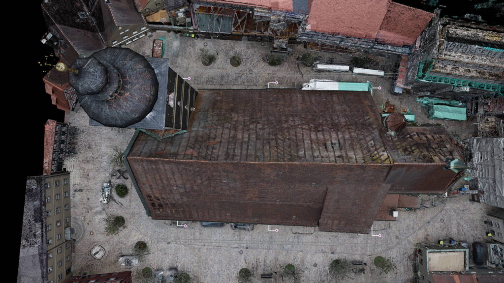
In drone surveying an object is captured photogrammetrically from the air. The drone flies a defined grid and takes hundreds of overlapping images, from which a coloured three-dimensional point cloud is computed. Metrika360 uses this where nothing works from the ground: roof areas, tall façades, terrain and inaccessible zones.
Several results come out of the same flight: an orthophoto, a digital surface and terrain model, an as-built site plan with contours, volume calculation and a photorealistic 3D model. Location is established through GNSS control points, in position in ETRS89 with UTM projection and in height in DHHN2016. The data therefore connects to the cadastre, building application documents and specialist design.
Where accuracy matters more than accessibility we combine the flight with 3D laser scanning. Both datasets hang on the same control network and are merged into one point cloud.
Seven cases in which the drone is the right tool
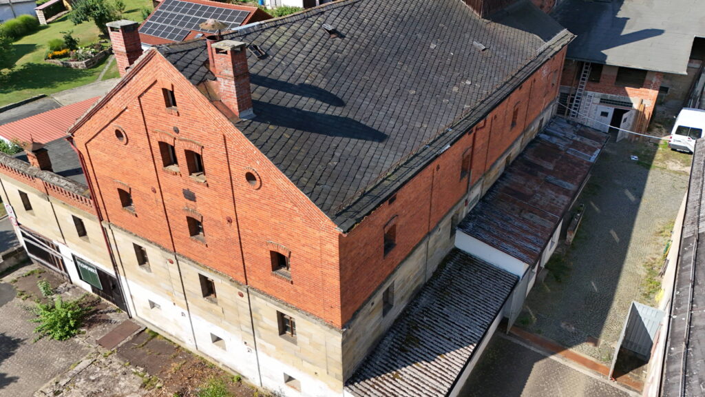
Roof areas. Condition survey, measurement for refurbishment, layout planning for photovoltaics. Without scaffolding, without a cherry picker and without anyone climbing onto the roof.
Tall façades. What is reachable terrestrially only from a cherry picker, or not at all, is captured from the air in a single pass. Including courtyards and rear elevations no vehicle can reach.
Large glass and metal surfaces. On glass façades a laser scanner produces false readings and holes, because the beam passes through or is deflected. Photogrammetrically the surface is preserved as an image and the geometry comes from the edges. Where the proportion of glass is high, the flight is therefore technically the better choice, not merely the more convenient one.
Terrain and outdoor areas. Comprehensive capture instead of individual spot heights. The basis for site plans, contours, earthwork volumes and drainage design.
Inaccessible and dangerous areas. Contaminated ground, plant areas in operation, structures over water. The surveyor stays on the ground.
Evidence and change over time. Repeated flights from the same positions make change measurable instead of merely describable. Settlement, construction progress, condition before and after a measure.
Expert reports and consent procedures. Captures to the specification of the appointed expert. Defined positions, defined flight heights above ground, defined pan and defined file format. We fly the specification; we do not interpret it. Typical in species-protection studies, environmental impact assessments and visibility analyses in wind energy and open-space projects.
How it works and how accurate it gets
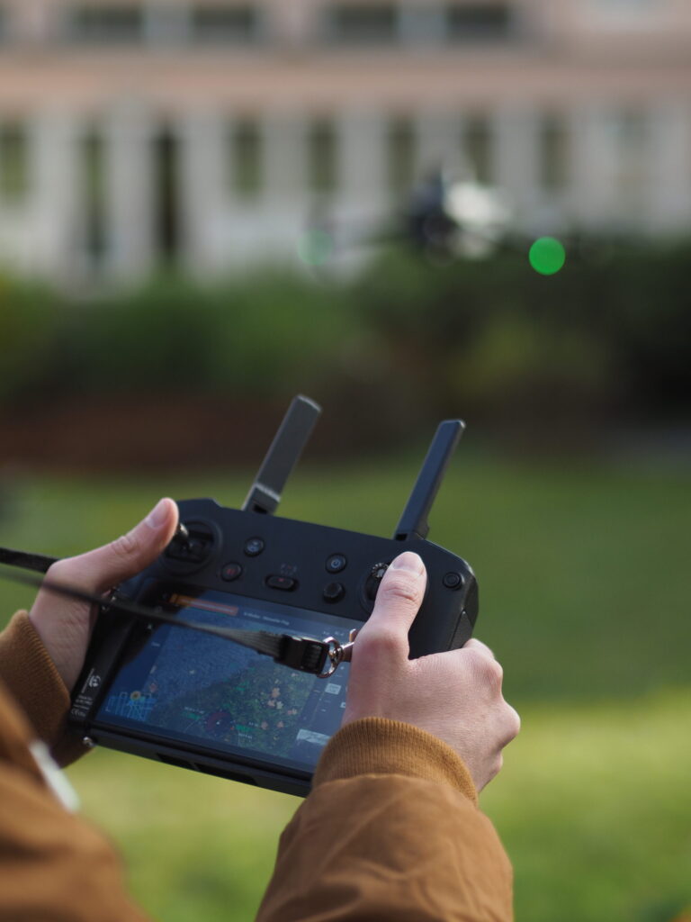
Unlike laser scanning, no laser pulse is emitted. Our drones take images at regular intervals which overlap heavily. From that overlap the software computes the camera positions and from them the spatial position of every image point. The methods behind this are called structure-from-motion and dense image matching.
The ground resolution at low flight altitude is under one centimetre per pixel. For comparison: the official digital orthophoto of the German state survey has 20 centimetres per pixel. Our capture is therefore about twenty times finer, and it carries the date of the day it was flown rather than a multi-year update cycle.
What is decisive for absolute accuracy is not the image resolution but the network of control points on the ground. We survey the control points with GNSS receivers and tie the flight to the official reference systems. With control points we achieve 2 to 5 centimetres in position. What that means is set out under georeferencing.
High point density and high accuracy are two different things. The flight describes a surface without gaps, whereas classical methods measure individual spot heights. That makes it superior for terrain and surfaces, but it does not replace terrestrial laser scanning where tight tolerances matter.
What the drone cannot do
A flight initially delivers a digital surface model. It contains everything standing on the ground: vegetation, vehicles, buildings, fences. A digital terrain model, that is the bare ground surface, only comes about by filtering those objects out.
That filtering has a physical limit. Where the camera cannot see the ground, no software can reconstruct it. Under dense vegetation, in woodland or on heavily overgrown embankments, photogrammetry therefore delivers no dependable terrain model. Where the ground is needed there, we add terrestrial capture or use LiDAR data.
Timing is part of the result too. A flight in leaf delivers a different terrain model from the same area in winter. Where the ground surface is the actual objective, we plan the appointment accordingly.
One flight, several evaluations
Orthophoto. A true-to-scale, rectified aerial image. Unlike a photograph you can measure in it, because every pixel has a coordinate. Ground resolution by agreement; 1 to 3 centimetres per pixel is usual.
Digital surface and terrain model. As a raster or a point cloud, with documented filtering and a stated capture time.
Site plan with contours. Site plan and terrain sections in DWG and DXF, height reference DHHN2016.
Volume and quantity calculation. Cut and fill as the difference between two states, with the comparison surfaces stated.
Point cloud. Vendor-neutral in E57 or LAS, combinable with terrestrial data and mobile mapping.
Photorealistic 3D model. A meshed and textured surface for visualisation, presentation and documentation.
Which results are needed determines the flight height, the overlap and the density of control points. That is why we settle them before the flight and not afterwards.
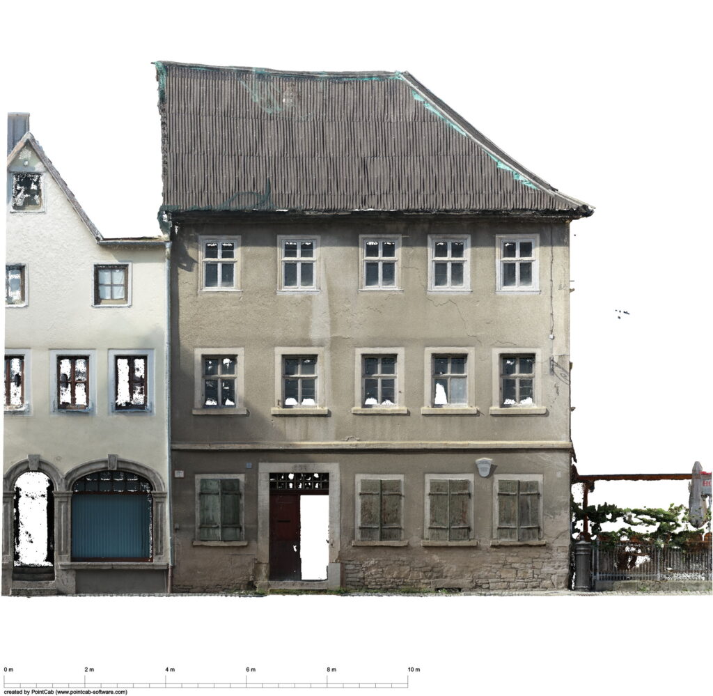
The same position, the same grid, comparable data
A flight is repeatable, and that is where its real value for building and terrain documentation lies. What matters is that the flight route, the capture positions, the flight height and the control point network stay identical between rounds. Only then is a deviation a change to the structure and not a difference in the capture method.
We fix the positions at the first appointment and fly them identically on every subsequent round. Evaluation is twofold: photographically as image and video documentation, and geometrically as a point cloud comparison against the previous state. Settlement, deformation and construction progress thereby become measurable instead of merely describable.
On a hydraulic structure we accompany the construction work in this way, with recurring flights from fixed positions and a running comparison of the point clouds against the previous state.
More: construction progress documentation · as-built comparison
Securing evidence: the documented state, comprehensive and dated
Anyone building across third-party land ends up negotiating about states nobody can any longer prove. An orthophoto of the corridor concerned answers that differently from a collection of individual photographs: it is comprehensive, true to scale, located in national coordinates and carries an unambiguous capture date. Every spot can be located and measured afterwards, including the ones nobody thought of at the time.
Typical occasions are pipeline and cable routes across agricultural land, construction work next to existing buildings, the handover of leased and rented areas, and evidence of land restoration. It makes sense to capture before works begin and after they are finished, because only the comparison of both states answers whether a change was caused by the works.
For a grid operator we captured the corridor of a buried cable route as a continuous orthophoto and derived from it the evidence towards the affected landowners.
The legal framework: what has to be settled, and what of it we take on
Whether flying is permitted at a given location depends on its geography, its surroundings and the object. Proximity to airports and airfields, railway installations, federal trunk roads, industrial plants, hospitals, nature reserves and housing leads to different conditions. As a rule this is solvable, but it needs lead time.
We check the situation before quoting, take on the necessary applications and bring proofs and insurance with us. What is needed on your side is the landowner’s consent and agreement on the capture times.
On flights over inhabited or trafficked areas, people and number plates are made unrecognisable in the delivered data.
Photogrammetry and laser scanning from one source
Both methods, one control network. We evaluate drone data and point clouds from terrestrial scanners and mobile mapping systems together. Both datasets hang on the same control point network; the handover is one dataset and not two.
The evaluation is the actual service. The flight takes hours; the evaluation decides the result. Filtering, classification and derivation turn images into a drawing.
Output formats without detours. E57, LAS, DWG, DXF, GeoTIFF, IFC. What you can read in is determined by you, not by us.
Official reference where it is needed. ETRS89 with UTM projection and DHHN2016 via surveyed control points.
Lead time and reliability. For a regular flight we plan two to three weeks of lead time. In that period we check the permit situation at the location, obtain the necessary permissions and schedule personnel and equipment. In urgent cases we are ready to deploy within a week.
If it has to be, the next day too
For a wind farm project in Brandenburg the enquiry came in at midday on a Tuesday, the cost estimate was with the client 17 minutes later, the commission followed the same afternoon, the flight took place on Wednesday and the data was available on Thursday. Twelve videos at four positions in three flight heights, exactly to the specification of the appointed expert.
What that can do and what it cannot: at short notice, whatever can be flown without a special permission is possible. If the location lies in a control zone, over railway installations or in a protected area, the authority decides the date, not us. We say that before the commission, not afterwards.
Pricing
What drone surveying costs
What drives the price of a flight
- Size of the area
- Required accuracy and therefore the flight height
- Effort for control points on the ground, which often takes longer than the flying itself
- Permit situation at the location
- Desired output formats
- Number of repetitions
Further reading
- Orthophoto – the measurable image from the flight
- Terrain model – DTM and DSM from the same data
- 3D laser scanning – terrestrial, where tight tolerances count
- Construction progress documentation – the recurring flight during construction
- As-built comparison – built condition against the design
Frequently asked questions about drone surveying
How accurate is a drone survey?
With surveyed GNSS control points we achieve 2 to 5 centimetres in position, and inherently somewhat less in height. The ground resolution of the images is under one centimetre per pixel at low flight altitude. What is decisive for absolute accuracy is the control point network, not the camera. Without control points the dataset is internally consistent but not located.
Do you need control points on the ground?
For any statement in national coordinates, yes. We survey the control points with GNSS and distribute them over the area. Without control points we deliver a result that is correct to scale but not officially located. That cannot be added afterwards; it would need another flight.
May you fly at our location, and who applies for it?
That depends on the location. Proximity to airports, railway installations, industrial plants or housing leads to conditions. We check that before quoting and take on the necessary applications. From you we need the landowner’s consent and agreement on the timing.
What is the difference between a terrain model and a surface model?
The surface model shows everything standing on the ground: vegetation, vehicles, buildings. The terrain model shows the ground surface and only comes about by filtering. Earthworks and drainage need the terrain model; shading, solar and the volume of above-ground objects need the surface model.
Can you see under trees?
No. Photogrammetry captures only what the camera sees. Under dense vegetation no dependable terrain model arises. Where the ground is needed there, we add terrestrial capture or fall back on LiDAR data. Areas that cannot be seen we mark as interpolated.
What is the difference between an aerial photograph and an orthophoto?
An aerial photograph is distorted by perspective; in the orthophoto that distortion has been computed out. Every pixel therefore has a coordinate and you can measure in it as in a drawing. The official orthophoto of the German state survey has 20 centimetres per pixel; our flight usually 1 to 3 centimetres.
How large may the area be and how long does a flight take?
The area is rarely the limit; the required resolution is. The lower you fly, the finer the result and the more flights are needed. On top comes the effort for the control points on the ground, which often takes longer than the flying itself.
Do you fly in wind and rain?
Rain and strong wind lead to abandonment or postponement. For terrain captures the season also matters, because vegetation changes the result. Where the ground surface is the objective, we plan the appointment for the leafless season.
What happens to people and vehicles in the images?
People and number plates are made unrecognisable in the delivered data. On flights over inhabited areas we agree the approach in advance.
Can drone data be combined with laser scans?
Yes, on buildings that is the normal case. The drone captures the roof and the upper façade, terrestrial laser scanning the accessible areas and details, mobile mapping the interiors. All datasets hang on the same control network and are merged into one point cloud.
How quickly can you be on site?
As a rule we plan two to three weeks of lead time for the permit check and scheduling. In urgent cases we are ready within a week, in individual cases the next day. What is decisive is the permit situation at the location: in control zones, over railway installations or in protected areas the authority sets the date. We settle that before the commission.