


Listed buildings: deformation-accurate survey and building recording
A historic monument is not right-angled. Walls lean, beams have settled, no room is a rectangle. A survey that smooths out these deviations is worthless for design. We capture the geometry as it is and pass it on unadjusted.
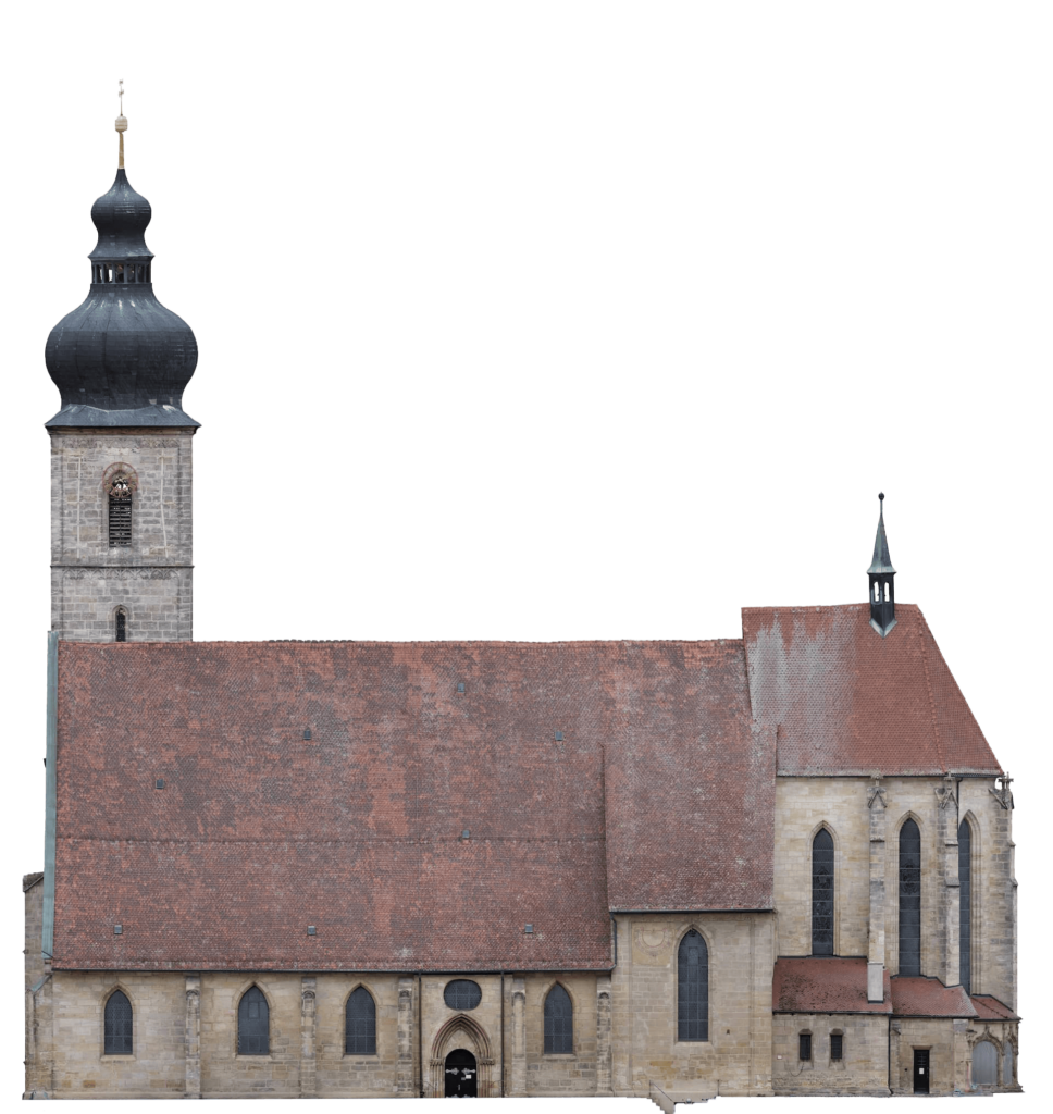
Here, deformation is the information
In a historic monument, the deviation from the right angle is not a measurement error but the subject of the investigation. A straightened drawing would be a falsification here.
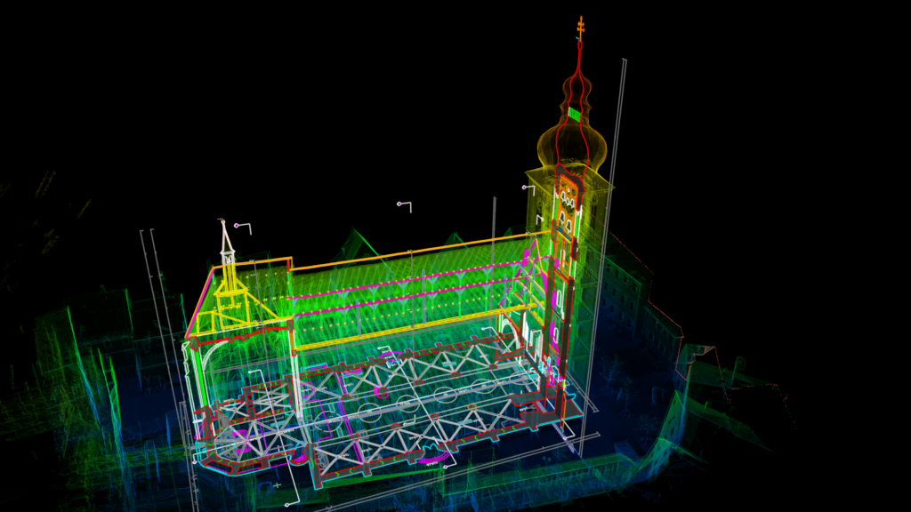
The image shows a church building as a wireframe model from the survey. What was measured is what gets drawn — that is the difference between a deformation-accurate survey and a clean drawing.
Where it goes wrong
With a manual survey, the error does not arise during measuring but during drawing. Anyone who measures a wall and then draws it straight has lost the very deformation that matters. Yet this deformation is the subject: it shows what has moved, and it is the reference for every later repeat measurement.
The second point is completeness. With a historic monument, you do not know before design begins which detail will become important later. A selective survey decides this in advance, and usually gets it wrong.
When the need arises
- Repair, change of use or conversion of a listed building
- Requirements from the heritage authority calling for a building survey
- Damage documentation on the facade, roof structure or vaults
- Monitoring a deformation over time, with repeat measurement
- Recording the existing structure before works in its vicinity
How we survey
We survey historic monuments terrestrially, with laser scanners from Faro, achieving sub-centimetre accuracy. Capture is area-wide and complete, not selective: what looks unimportant today is still available in the point cloud later on.
We fly the roof, tower and upper facade areas with a drone. Both surveys are registered together, so that interior, facade and roof come together in one model.
From this survey, deformation-accurate sections and elevations are produced. Deformation-accurate means: the drawing shows the wall with its inclination and its bulging, not an idealised straight line.
Why the survey is always deformation-accurate here
A laser scanner does not measure individual points but surfaces. Depending on the settings, millions of points per square metre are produced, and every inclination and every bulge is already contained in them. A conventional method can achieve the same, but its effort grows with every additional point. That is why it is simplified in practice, and that very simplification is the loss.
The second step has to be kept separate. The measurement is deformation-accurate; the drawing derived from it is not automatically so. Whether it becomes so is decided by the person drawing it. That requires someone who can work with point clouds and also knows the building craft of earlier centuries, otherwise things get straightened again during drawing.
What a deformation-accurate drawing contains
Depending on the agreed level of detail, the drawings include, among other things:
- The structure in its actual position, including distortion and settlement
- Decorative elements of the facade
- Timber joints such as tenons and laps, where visible
- Changes of material and construction phases, insofar as they can be read from the existing fabric
Where there is no acute need for action, the point cloud alone is already a result: it documents the condition completely and allows a virtual walkthrough, even years later and without anyone entering the building. If work on the structure is due, the structural assessment can be built on the same basis.
What you receive
- Deformation-accurate floor plans, sections and elevations
- Registered point cloud of the entire surveyed building
- Orthophoto of the facade as a measurable image basis for damage mapping
- Isometric representations when the structure needs explaining
- As-built model if design is carried out in BIM
For damage mapping, the orthophoto is the decisive part. A crack can be located and measured in it, and found again at the same spot in the next survey.
Coordination with the heritage authority
What a building survey must contain is rarely stated in full in the official decision. More often it states that a deformation-accurate survey must be submitted – and the scope only becomes clear in discussion.
That is why we coordinate before the survey when the authority sets requirements: which levels are drawn, at what scale, which details are to be shown, and whether damage mapping is part of the service. This costs one meeting and saves rework after submission.
What is regularly underestimated in this coordination: the survey itself is complete, the drawing is a selection from it. What is not drawn today is not lost – it is in the point cloud and can be added later without climbing the scaffolding again.
Monitoring deformation over time
For a structure that moves, a single survey is a snapshot. It becomes interesting the second time.
If the survey is georeferenced, a later measurement can be overlaid on it and the change shown across the whole surface – not as the difference between individual measuring points, but as an image of the entire wall. Where something has moved, it becomes visible there, even in places where nobody would have set a measuring point.
The prerequisite is that both surveys are in the same system and that the control points remain permanently marked. Both involve little effort the first time and cannot be made up for later.
Further reading
- Deformation-accurate surveys – the service in detail
- 3D laser scanning – the terrestrial method
- Orthophoto – measurable facade image for mapping
- Drone surveying – roof, tower and upper facade
- Point cloud – why capture is complete
- As-built drawings and models – sections, elevations, formats
- For architects and planners – as-built data for design
Frequently asked questions
What does deformation-accurate mean?
The drawing reproduces the actual geometry, with inclinations, bulges and settlements. It is not straightened to right angles. In a historic monument, these very deviations are the subject of the survey.
Is the method safe for the building?
Yes. Laser scanning is contactless; nothing is attached and nothing is loaded. For sensitive surfaces, this is the main advantage over a manual survey.
How accurate is the survey?
Terrestrially, in the sub-centimetre range. For the roof and upper facade we add a drone flight; its accuracy depends on the flight distance and is defined for each specific building.
Can we monitor the deformation over the years?
Yes. If the survey is georeferenced, a later measurement can be overlaid on it and the change shown across the surface rather than at individual measuring points.
Do you work with the heritage authority?
We agree scope and presentation in advance when the authority sets requirements for the building survey. This saves rework after submission.