


For architects and plannersReliable as-built data for your design
Designing in an existing building means designing on other people’s assumptions – as long as the basis comes from paper drawings that nobody has checked since the last conversion. We deliver the actual condition, surveyed and processed at the level of detail your work stage requires.
The design basis
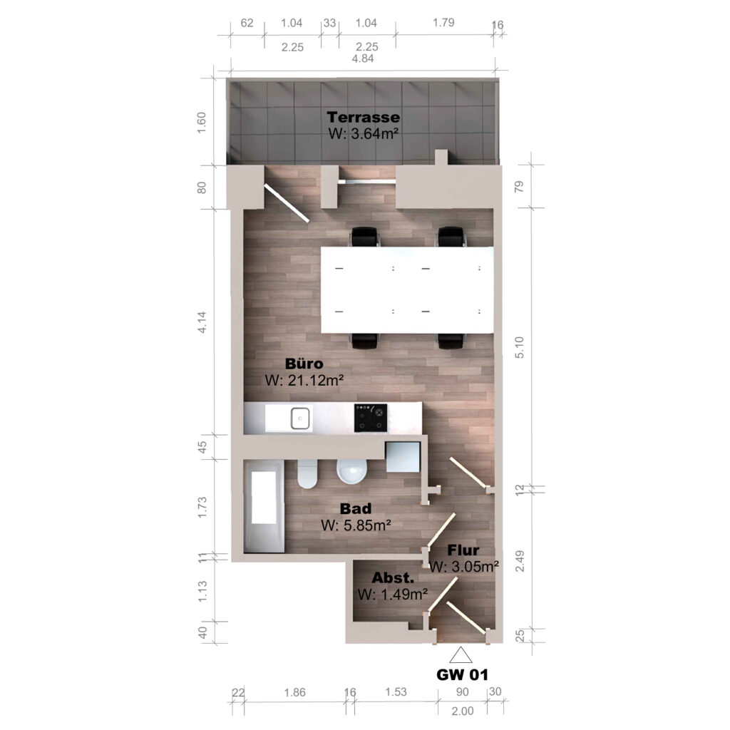
An as-built drawing, drawn from the survey. Not a traced old drawing whose status nobody knows, but the geometry of the building as it is today.
Your tasks
| Task | Benefit | What you receive |
|---|---|---|
| As-built survey for conversion and refurbishment | A reliable basis of the actual condition instead of outdated drawings | 2D drawing set and BIM as-built model at the LOD of your design stage |
| Design basis in Revit or ArchiCAD | Model directly in your own CAD, without exchange losses | RVT, IFC, PLA, PLN or 3D DWG |
| Area verification | Verifiable areas | Room book to DIN 277 as an Excel list, floor plans with room stamps |
What you receive, and in which format
The delivery depends on the work stage, not on a standard package. When establishing the basics, a dimensionally accurate drawing set is often enough; as soon as tendering or prefabrication begins, the accuracy requirement changes fundamentally.
- 2D drawing set as DWG and PDF: floor plans, sections, elevations, prepared to your CAD guideline – layer structure, title block, scale usually 1:100.
- As-built model at the agreed level of detail, vendor-neutral as IFC and additionally in the format of your design software.
- Point cloud as E57. It remains the evidence against which every drawing can be checked.
- Areas to DIN 277, as a list and as stamps in the drawing.
What is not in the specification of services is not modelled. That is not hair-splitting but the most common reason for disputes at handover.
What we need from you
Four pieces of information determine effort and result. If they are available before the survey, the delivery can be planned; if they come afterwards, rework follows.
- The work stage for which the basis is needed. This determines the level of detail.
- Your CAD guideline. Without it, we deliver to our standard, which may then not fit your filing system.
- The scope. The whole building or the area around the planned works – both are common, the second is often sufficient.
- Access and time window. For occupied or operating buildings, this is the point that determines the date.
Where as-built data fails
Three recurring patterns, and all three only become apparent during construction.
- The old drawing was traced instead of surveyed. The result looks like an as-built survey and is a copy of the condition back then. Conversions from recent decades are missing from it entirely.
- The level of detail does not match the use. A model for preliminary design does not carry dimensions that prefabrication can rely on. You notice this with the first component that does not fit.
- The point cloud was not delivered. Then a query from construction can no longer be resolved from the dataset, only on site.
That is why we check the derived model against the survey before handover, and we always deliver the point cloud with it. See also Scan-to-BIM.
Frequently asked questions
What level of detail do I need for which work stage?
When establishing the basics, LOD 200 is usually enough; for detailed design, LOD 300 is needed. What matters is less the number than the list of components and attributes behind it – that belongs in the specification of services.
Do I get the data in my CAD format?
Yes. Drawings as DWG and PDF, models vendor-neutral as IFC and additionally in the format of your design software. The layer structure follows your CAD guideline, if one is available.
Can you survey while the building is in use?
Yes. We capture interiors with mobile mapping on foot, without a tripod and without cordoning off. Only what is to be surveyed has to be accessible.
What if a question comes up during construction?
Then it is answered from the point cloud. It is always delivered and records the condition completely – including the dimensions nobody asked for during the survey.
How accurate is the survey?
Terrestrially, in the sub-centimetre range. For large interior areas we use mobile mapping; the result is dimensionally accurate and fully usable for floor plans and areas, but does not reach the accuracy of stationary scanning.

Take a look at a survey
We will show you the drawing, model and point cloud from a building similar to yours. This lets you judge whether the level of detail suits your work stage.
Where to go from here
- Scan-to-BIM and as-built data – the pillar for everything that goes into design
- Digital as-built drawings – floor plans, sections and elevations as a design basis
- BIM as-built models – at LOD 200, 250 and 300
- Deformation-accurate surveys – when the existing building deviates from the regular
- Levels of detail explained – which level is suitable for what