


Technology and equipment: which method when
No single method can do everything. A terrestrial scanner sees details a drone never sees; a drone sees a roof no tripod can reach. Which instrument is used is decided not by the equipment available but by the task. This page names both: what we have and how we decide.
What we work with
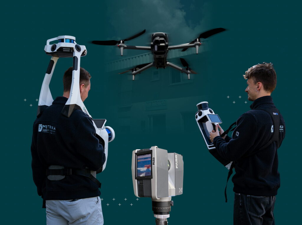
Mobile laser scanners, a FARO Focus on its tripod and the drone: the equipment we survey with.
Terrestrial laser scanning
Instrument: FARO Focus Premium. Accuracy: below 1 cm, sufficient for detailed design and connection planning.
The scanner stands on a tripod and measures what it sees from each station. What it does not see does not exist in the capture — which is why the number of stations determines completeness, not the resolution of the instrument.
When it is the right method: when construction is based on the capture. Connection points, façade details, structural framework, plant rooms with dense geometry. Wherever a centimetre of deviation means rework on site.
Mobile mapping
Instruments: NavVis VLX and NavVis MLX. Output: more than 8,000 m² per day possible.
A wearable scanner that measures while you walk. No tripod, no station changes, no interruption to operations. For large areas it is many times superior to the tripod — not because it is more accurate, but because it manages in one day what the scanner needs a week for.
When it is the right method: floor areas, long corridors, building stocks across several buildings, surveys during ongoing operation. In short: wherever the area is the problem and not the detail.
Drone and photogrammetry
Instrument: DJI Matrice 4E. Use: roof, façade and terrain.
From overlapping aerial images, photogrammetry computes a point cloud and from it orthophotos and terrain and surface models. The advantage lies not in accuracy but in reach: a roof without scaffolding, a façade without an aerial work platform, a site without walking it.
When the drone is the wrong choice — and we state this deliberately, because nobody else does: no terrain model can be produced under vegetation. The camera sees leaves, not the ground beneath them. What you get is a surface model (DSM), and anyone who needs a terrain model (DTM) then needs a different method or a different date in winter.
GNSS and control points
Instrument: Emlid. Reference systems: ETRS89/UTM for position, DHHN2016 for height.
A capture without a spatial reference is a model floating in a vacuum. It can be evaluated in itself, but it cannot be combined with a cadastral plan, a neighbouring building or a second capture. Control points establish this reference — why this is not a formality is explained in the glossary entry georeferencing.
Which method when
The decision is made by the task, not by the building type:
- Construction will be based on it → terrestrial scan. The centimetre counts.
- It is about areas and operation → mobile mapping. The area counts.
- It is high up or outdoors → drone. Reach counts.
- It has to fit with other data → GNSS control points, in addition to one of the three.
In most projects it is not one method but a combination: envelope by terrestrial scanning, interiors by mobile mapping, roof by drone, everything tied to a common system via control points. That is one appointment and one point cloud, not three projects.
Further information
- 3D laser scanning – the service built on terrestrial scanning and mobile mapping
- Drone surveying – what results from the flight
- Scan-to-BIM – the path from capture to as-built model
- Mobile mapping or terrestrial – the comparison as a glossary entry
- Georeferencing – why the capture needs a spatial reference
- Prices – what a survey costs and what the price depends on