


Mobile mapping or terrestrial laser scanning?
Mobile mapping captures while walking, with a body-worn laser scanner, and is designed for area coverage. Terrestrial laser scanning measures from fixed stations on a tripod and is designed for accuracy. Most projects use both.
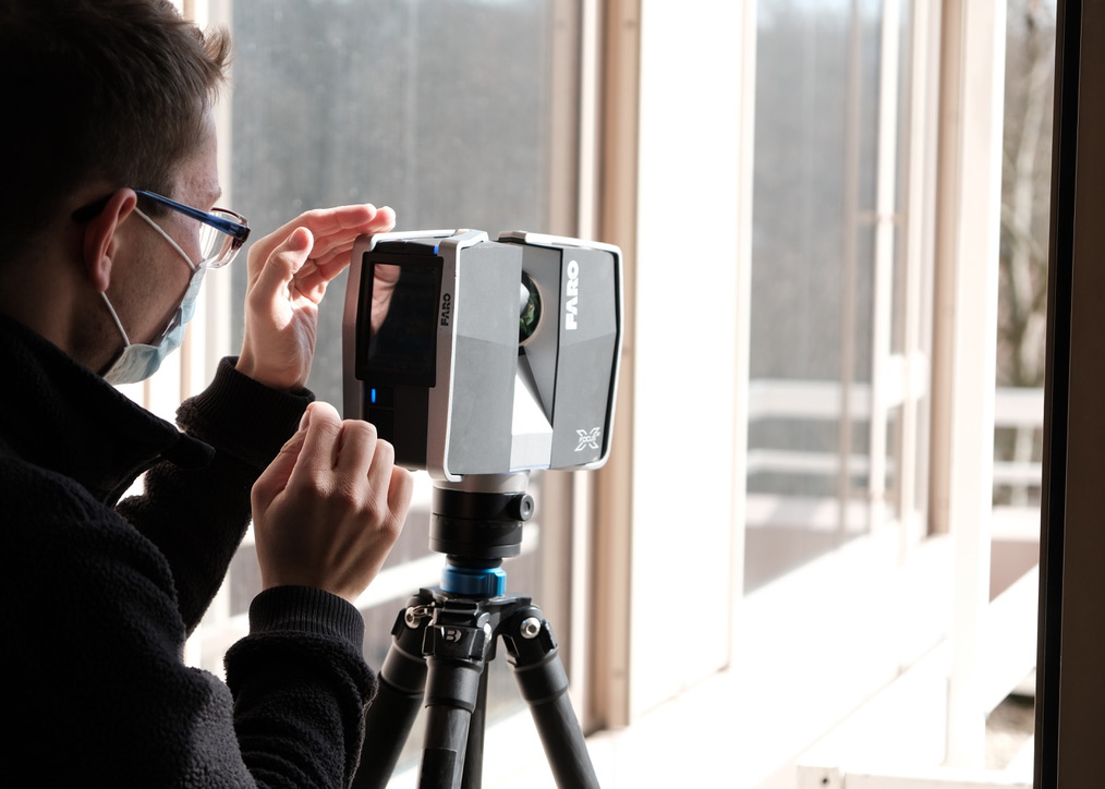
From the tripod
The terrestrial scanner stands still, measures and is moved on. That takes time and in return delivers the highest accuracy. Mobile mapping takes the other route.
The difference in practice
Mobile mapping is suited to interiors and large contiguous areas. The operator walks through the building; there are no stations, no cordoned-off areas, and operations continue. For a room book or a CAFM data capture across many floors, it is the economical route. The result is dimensionally accurate, to within 2 to 3 cm.
Terrestrial laser scanning is suited to building envelopes, façades, structural systems and wherever the individual dimension matters. The scanner stands still and every position is registered. Here we work in the sub-centimetre range.
The accuracy statement belongs to the method
This is more than a question of wording. Anyone who promises millimetre accuracy for a capture made while walking is promising something the method cannot deliver. We therefore keep the figures separate: sub-centimetre for terrestrial capture, 2 to 3 cm for mobile mapping. Which method was used where is stated in the delivery documentation.
How the two come together
Both datasets are combined via a common control network. The spatial reference is established via GNSS in ETRS89/DHHN2016 and is therefore fit for official use – so the capture fits into existing design states and official reference systems.
Why the accuracies differ
The difference lies not in the measuring technology but in whether the device is stationary. A terrestrial scanner measures from a fixed, known station – every point refers to the same origin. That is why we state sub-centimetre there.
With mobile mapping the device moves, and its own position is calculated continuously along the way. Small uncertainties in this trajectory carry over into every measured point. The result is dimensionally accurate, to within 2 to 3 cm, and fully usable for areas, floor plans and room books – but it does not reach the accuracy of stationary capture, and so we do not describe it that way.
What this means for throughput
The difference in speed is considerable, because in the stationary method the station changes set the pace. Approved empirical values for mobile mapping:
- Logistics and warehouse areas: up to 15,000 square metres a day
- Office buildings: 3,000 to 6,000 square metres a day, depending on how finely the floor plan is subdivided
The range for office buildings comes from the number of rooms, not the area: every door is a stop, every corridor of individual offices a separate loop.
When to use which method
- Terrestrial when prefabrication is involved, when connecting to plant systems, when deformations are documented or when a listed building is captured.
- Mobile mapping when many rooms are captured over a large area: residential portfolios, office buildings, hospitals, warehouses, schools.
- Both when a building contains both – which is the normal case. The envelope terrestrially, the interiors while walking, calculated on a common network.
Operations often have a say
In a hospital, a running production facility or an occupied building, the question of method is also the question of how long someone stands in the room. A tripod in the middle of a ward corridor is something different from someone walking through. This is not a side issue, but often the reason a project happens at all.
Frequently asked questions
Is mobile mapping less accurate than terrestrial scanning?
It is designed differently. Mobile mapping delivers dimensionally accurate results (2 to 3 cm) over large areas in a short time. Where the individual dimension matters – façade, structure, detail – terrestrial scanning is used, and there the figure is sub-centimetre.
Do operations have to be interrupted for the capture?
With mobile mapping, as a rule, no. Capture takes place while walking, without a tripod and without cordoning off. Terrestrial stations briefly need a clear line of sight.
Can both be combined in one project?
That is the normal case: interiors while walking, envelope and detailed areas from the tripod. Both datasets are combined via a common control network.